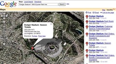
While not a pure law firm technology tool, the new Google Mapping tool is just too amazing to pass up. The core technology behind this is based on a product called Keyhole, which Google recently purchased. Keyhole is basically Terraserver on steroids, it provides satellite images of the entire globe, the ability to 'fly' from one point to another, and the ability to drill down to very fine detail. As the site says, "you can fly through 12+ Terabytes of Earth imagery and data – spinning, rotating, tilting, and zooming. Think magic carpet ride".
This technology is available through Keyhole directly for a fee, but you can get access to a 'lite' version of it through Google Maps. Leisure travelers will enjoy being to 'see' exactly how a hotel is laid out, or how close it is to the ocean. For business use, many real estate lawyers will find this tool invaluable when making a personal visit to the site is not feasible, cost effectively or timely. To see an example of the Google Maps tool, take a look at the satellite image of Dodger Stadium.

No comments:
Post a Comment